OpenStreetMap初探(三)——几个重要概念
本文共 768 字,大约阅读时间需要 2 分钟。
先看几个比较重要的名词:
Tiles
Tiles are rectangular slabs of ceramic affixed in a grid arrangement to your bathroom wall! But here we're much more likely to be talking about map tiles: square bitmap graphics displayed in a grid arrangement to show a map. We may also be talking about tiled map data (described below)网上有的翻译为瓦片,个人理解为地图切片。简单的说,就是把一张大大的地图,分割成许多小正方形(如下)。这样在加载地图的时候,只需要把区域内相关的小正方形加载出来就可以了。
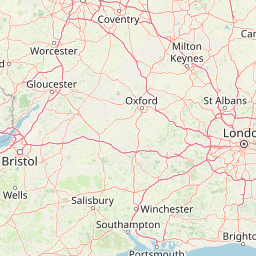
(格式:/{LEVEL}/{ROW}/{COL}.png[/Url])
如上图,Map tiles 通常是256 x 256 像素的,虽然这不是一定的,但由于Google Map的影响,这其实已成为实际的标准。
WMS
WMS 为 W eb M ap S ervice的缩写. 它是符合 标准的HTTP上的地图图像服务。
Routing
Routing(或navigation),通常称之为导航。OpenStreetMap为驾车、步行、骑车、骑马等方式均提供了导航信息。目前已有许多离线的、嵌入的、或者基于网络的使用OpenStreetMap数据的导航服务。
Rendering
Readering:通过原始的地理数据渲染出可视化地图的过程。通常,这个过程还可以包含图像的绘制、地图切片的制作或者矢量、3D类型地图的制作。
一些地图渲染的软件可参看这里:
转载地址:http://ewrbi.baihongyu.com/
你可能感兴趣的文章
解决python2.7中UnicodeEncodeError
查看>>
小谈python 输出
查看>>
Django objects.all()、objects.get()与objects.filter()之间的区别介绍
查看>>
python:如何将excel文件转化成CSV格式
查看>>
Django 的Error: [Errno 10013]错误
查看>>
机器学习实战之决策树(一)
查看>>
[LeetCode By Python] 2 Add Two Number
查看>>
python 中的 if __name__=='__main__' 作用
查看>>
机器学习实战之决策树二
查看>>
[LeetCode By Python]7 Reverse Integer
查看>>
[LeetCode By Python]9. Palindrome Number
查看>>
[leetCode By Python] 14. Longest Common Prefix
查看>>
[LeetCode By Python]107. Binary Tree Level Order Traversal II
查看>>
[LeetCode By Python]108. Convert Sorted Array to Binary Search Tree
查看>>
[leetCode By Python]111. Minimum Depth of Binary Tree
查看>>
[LeetCode By Python]118. Pascal's Triangle
查看>>
[LeetCode By Python]121. Best Time to Buy and Sell Stock
查看>>
[LeetCode By Python]122. Best Time to Buy and Sell Stock II
查看>>
[LeetCode By Python]125. Valid Palindrome
查看>>
[LeetCode By Python]136. Single Number
查看>>